
Territorial Identity Hondsrug
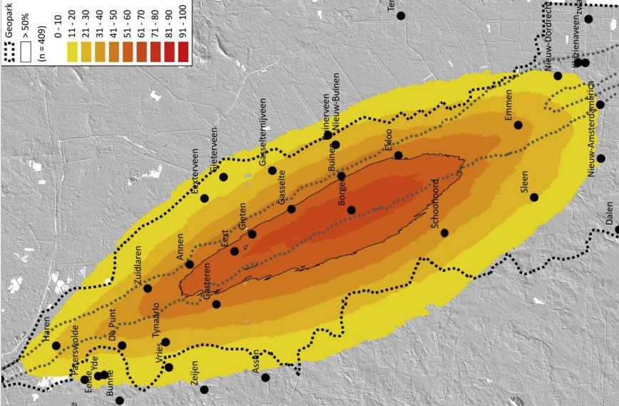
Using a quantitative case study of UNESCO Geopark De Hondsrug (the Netherlands), the paper shows a complex image regarding the inhabitants’ affinity with their living environment. At its initiation, the geopark did not build on the landscape associations of local inhabitants. Composite overlap mapping of mental maps drawn by inhabitants shows that the geopark incorporates an area that is substantially larger than the area interpreted by the inhabitants as constituting the Hondsrug. Nevertheless, the core area of the Hondsrug is recognized and lived by the majority of the people, providing a starting point for improving the community’s support for the geopark’s brand. We conclude that only when there is enough bottom-up recognition and embedding of the brand and its underlying landscape values, a geopark’s narrative can be effectively built on for endogenous regional development purposes.