A unique ice age landscape
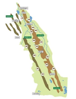
The Hondsrug UNESCO Global Geopark extends beyond the Hondsrug. It consists of several parallel ridges, separated from each other by stream valleys. The Hondsrug region runs from the centre of the city of Groningen in the north to the fortified town of Coevorden and the Bargerveen area below Emmen in the south. Apart from the sandy ridges, the stream valleys of the Drentsche Aa and the Hunze form a large part of the region. The region is seventy kilometres long with an average width of twenty kilometres. The highest point – near Emmen – lies thirty metres above sea level.
UNESCO Status
In November 2015 the whole region acquired the status of UNESCO Global Geopark. The region extends over two provinces – Drenthe and Groningen – and covers seven municipalities: Groningen, Haren, Tynaarlo, Aa en Hunze, Borger-Odoorn, Emmen and Coevorden. The population is 240,000, spread over an area of almost 1,000 km2. It is the only Geopark in the Netherlands. The Northern Netherlands is known internationally for its two UNESCO World Heritage Sites (the Waddenzee and the Wouda Pumping Station) and a number of National Parks. Worth special mention is the Drentsche Aa National Park which lies almost wholly within the Geopark region.
Core values
The Hondsrug region is home to a great variety of landscapes, dwelling types and cultural-historic elements. What is remarkable is that this diversity shares a unique unity which logically consists of three parts. These are (1) the ridges and stream valleys, (2) the archaeological wealth and (3) the cultural landscape related to them. This is the power of the Hondsrug region!
Geomorphology – ridges and valleys formed by the ice
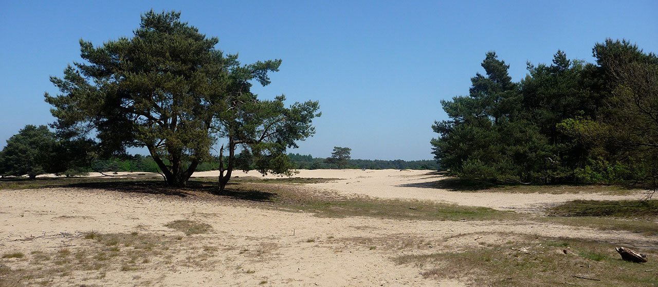
One look at the elevation map shows that the Hondsrug region consists of several straight ridges running parallel and alongside each other, the Hondsrug being the most prominent. These ‘megaflutes’ were shaped during the Saalian Ice Age about 150,000 years ago, when an ice mass from the North Sea region bulldozed over today’s Drenthe and Groningen. The pressure of the ice and the force of the melt water left behind this pattern of parallel ridges and depressions. Stream valleys such as the Hunze and the Drentsche Aa re-shaped the lower areas. Nowhere else in Europe is a similar system of ridges and valleys from the ice ages so well preserved and visible.
Visible archaeology – treasures from our ancestors
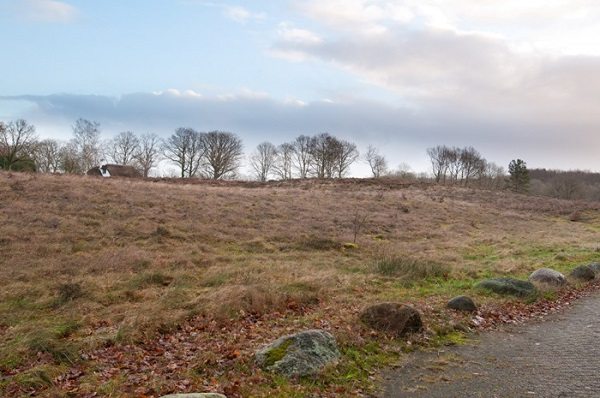
Human settlement and development of this region can be traced back to the ice age landscape of valleys and ridges. After the last ice age, about 10,000 years ago, the first people here were hunters and gatherers. In the stream valleys and woodland, which then covered this area, there was abundant food such as wild game, fish and edible plants. From ca. 3,000 BC the first farmers settled on the higher sandy ground, and they left behind their stone burial monuments, the hunebeds. Later inhabitants left hundreds of burial mounds, ‘celtic field’ complexes and traces of cart tracks which reveal ancient roadways. It is almost certain that a continuous prehistoric route ran over the Hondsrug for thousands of years. Worldwide, only few regions display such an enormous concentration of visible prehistoric traces.
Cultural landscape – man made
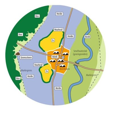
Today’s cultural landscape forms the third part of the Hondsrug region. Formed over thousands of years by human activity, its origins can be traced back to the structure of ridges and valleys from the ice ages. From west to east, the landscape alternates between high and low. Today’s farming villages (‘esdorpen’) on the ridges arose in the Middle Ages when the inhabitants laid out their agricultural fields – ‘essen’ in Dutch – on the higher sandy soil along a stream valley. Much later, at the time when peat was being dug, the ‘peat colony’ settlements arose to the east of the Hondsrug in the Hunze valley. The names were derived from the villages on the Hondsrug, such as Buinen – Buinerveen – Nieuw-Buinen. Thanks to the centuries-long intensive inhabitation, the original pattern of streams has remained well preserved and the Hondsrug region now has a National Park (Drentsche Aa) and several nature areas with a European Natura 2000 status.